 copyright: OBK
Heavy Rainfall Risk Management
This page was translated from German using artificial intelligence. The translation may contain errors or inaccuracies. In case of doubt, the German original version prevails.
As part of the district-wide heavy rain risk management, it was determined for the Oberbergischer Kreis which buildings and infrastructure facilities are at risk from flooding and heavy rain. The maps created enable citizens, businesses, and infrastructure operators to assess to what extent there is a need for individual precautionary measures for their properties. The goal is to minimize risks and prevent damage during heavy rain events.
Heavy Rainfall Hazard Maps
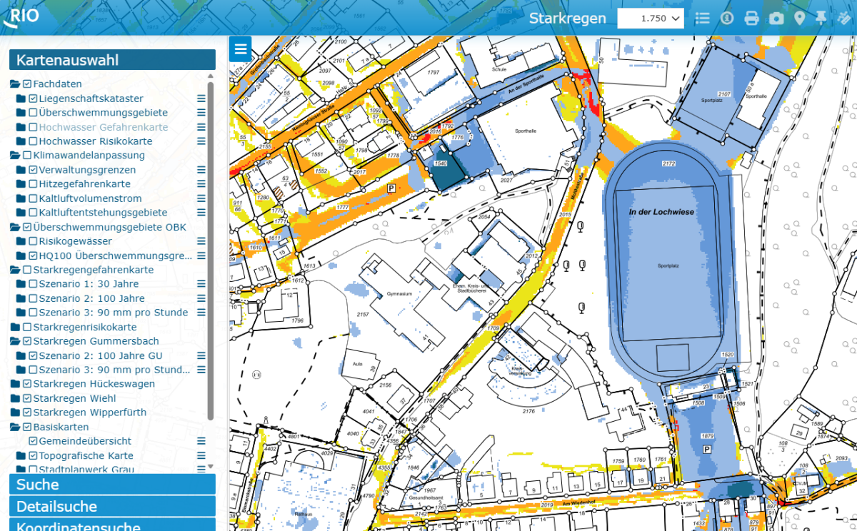
Heavy rainfall hazard maps are simulations that depict the extent of flooding, water levels, inundation depths, and flow directions under various rainfall scenarios.
The maximum water level reached at each location during the simulation period is displayed. This makes it very easy to identify vulnerabilities on properties that may face flooding situations.
Click here to access the heavy rainfall maps.
Heavy rain risk maps
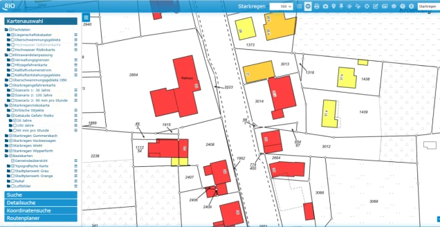
The heavy rainfall risk map provides information about the vulnerability of affected buildings, public facilities, monuments, industrial and commercial areas, etc., in the event of a heavy rainfall event. Various classes of flood risk are differentiated. Particular emphasis is placed on important infrastructural and administrative facilities such as buildings of emergency services or basic services.
Click here to access the heavy rainfall risk maps.
Downloads
Guide to RIO Raum-Information Oberberg
Frequently asked questions
Heavy rain refers to intense rainfall over a short period. Heavy rain is usually localized. The German Weather Service issues warnings in three stages:
Heavy rain:
15 to 25 liters per square meter in one hour or 20 to 35 liters per square meter in six hours
Severe heavy rain:
25 to 40 liters per square meter in one hour or 35 to 60 liters per square meter in six hours
Extremely severe heavy rain:
more than 40 liters per square meter in one hour or more than 60 liters per square meter in six hours
However, there is no uniform definition of the term "heavy rain." The term is used – depending on the context – for rain of varying intensity and severity.
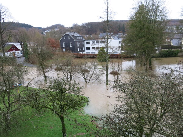
Events in recent years have shown that essentially all regions can be affected by this natural hazard. Unlike flooding of major rivers, the exact location and timing of heavy rain are difficult to predict and can be very surprising for those affected.
Warning times, during which short-term measures can still be taken, are therefore very short or even non-existent. Especially in small catchment areas, smaller water bodies like streams can suddenly swell, overflow, and cause flooding due to the rain volume.
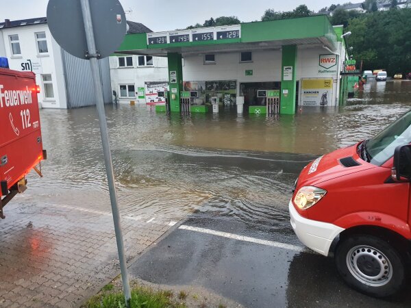
During flooding caused by heavy rainfall, the ground can no longer absorb the precipitation or cannot absorb it quickly enough. The water flows across the terrain surface towards the nearest body of water or other low points in the terrain, such as ditches, depressions, or basement rooms.
Flooding with just a few centimeters of depth can occur almost across the board in residential areas. This is because the ground in settlements is mostly built upon, that is, sealed. However, across the area, heavy rainfall can also lead to greater flood depths in different locations.
In particular, in hilly or mountainous terrain, flash floods caused by heavy rainfall have high flow forces and can carry large amounts of debris (such as wood, hay, and silage bales) and eroded materials (like soil or rubble). This material can then accumulate at bottlenecks or bridges and block them. The resulting backwater floods the surrounding terrain and can cause further severe damage to buildings and infrastructure.
Even in flat areas, heavy rainfall can cause flooding. Since the large amounts of water often exceed the design limits of sewer networks, the water cannot drain underground, and the rainwater floods wide areas. In particular, buildings and infrastructure in depressions can be significantly damaged.
On the website Hochwasser Pass of the Flood Competence Center (HKC) e.V., you will find a wealth of information materials on the topic of self-protection.
The municipal heavy rain hazard maps show the results of simulations that reflect the current state of technology. The county-wide calculations depict surface runoff based on a digital terrain model. The public sewer system is not considered in the simulation, as it no longer has a significant influence during these extreme rainfall events.
The heavy rainfall hazard maps serve as a first orientation since details such as property walls or curbs, which can alter water flow, are not depicted in the district-wide terrain model. The flooding results must also be verified through on-site inspections. If there are entry points to buildings in the depicted flood areas, such as basement entrances or light well openings, it is advisable to implement object protection measures at these locations.
The maps thus provide owners, businesses, and those affected with the opportunity to assess the risks to their property and, if necessary, take object protection measures. They thereby form a fundamental basis for effective civil protection.
The heavy rainfall hazard maps will serve as a planning basis for all urban planning in the future. Together with the damage potential and risk analyses as well as the river flood maps from the district government, they form the basis on which all water management planning for extreme events is assessed and aligned.
In addition, the heavy rainfall hazard maps serve as a basis for disaster protection planning by the fire department and local rescue forces.
Contacts at the Oberbergischer Kreis and in the cities and municipalities
The development of district-wide heavy rainfall risk management is the result of close cooperation between the Oberbergischer Kreis and the 13 cities and municipalities.
However, the respective municipalities are solely responsible for specific matters and locations. For this reason, your contacts are listed below:
City of Bergneustadt
Richard Pritzkau
Municipality of Engelskirchen
Andreas Kiel
City of Gummersbach
Jakob Kadura
Castle Town Hückeswagen
Andreas Schröder
Municipality of Lindlar
Michael Schneider
Municipality of Marienheide
Sebastian Kaiser
Municipality of Morsbach
Stefan Hermann
Municipality of Nümbrecht
Mario Gembruch
City of Radevormwald
Ulrich Dippel
Jochen Knorz
Municipality of Reichshof
Thorsten Schmidt
Ludger Müller
Market Town of Waldbröl
Rudolf Bergen
City of Wiehl
Alexandra Zimmer
Hanseatic City of Wipperfürth
Armin Kusche
Oberbergischer District
Coordination of district-wide heavy rainfall management
Thomas Groos
