 copyright: ©Image'in - stock.adobe.com
Bicycle mobility
This page was translated from German using artificial intelligence. The translation may contain errors or inaccuracies. In case of doubt, the German original version prevails.
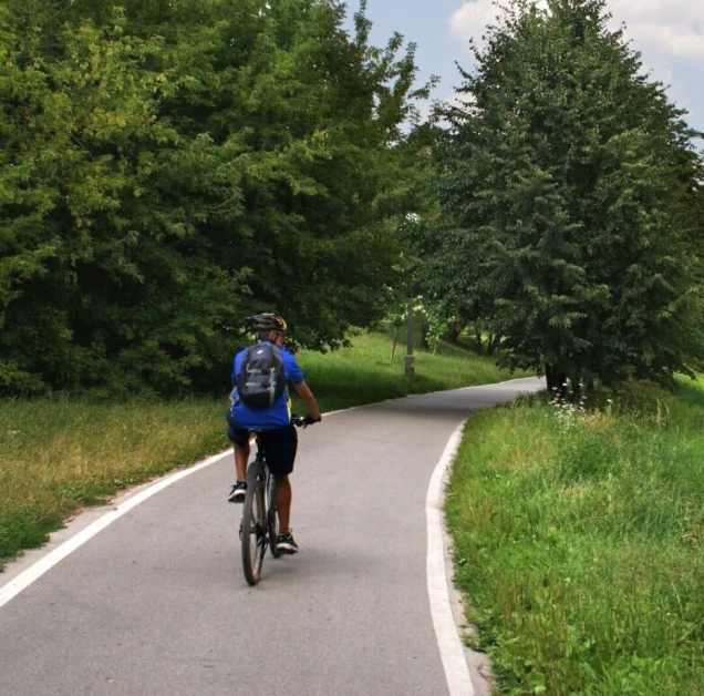
Whether cycling leisurely on an old railway track, tackling long distances sportily, or climbing steep paths to gain altitude – cycling in the Oberbergischer Kreis primarily takes place in the leisure and tourism sector.
Using bicycles – including those with electric assistance – has significant potential to save CO₂ and reduce pollutants. Since many everyday car trips within towns are shorter than five kilometers, some of these journeys can also be made by bike. Commuters arrive more relaxed at work and can improve their health along the way.
Promoting cycling mobility is a measure of the program Climate - Environment - Nature Oberberg. A key aspect of promoting bicycle mobility is the expansion of infrastructure to create new and safe connections.
Responsibilities for Bicycle Path Construction
The Oberbergischer Kreis, as the road construction authority, is responsible for the construction and maintenance of bicycle paths on district roads (K). Planning and construction of new bicycle paths on state and federal roads (L and B) are the responsibility of the Landesbetrieb Straßen NRW. For municipal roads, the 13 cities and municipalities in the Oberbergischer Kreis are responsible. The Oberbergischer Kreis supports municipalities in planning and implementing inter-municipal bicycle paths that connect cities and municipalities.
Cycling - Everyday, Leisure, Tourism
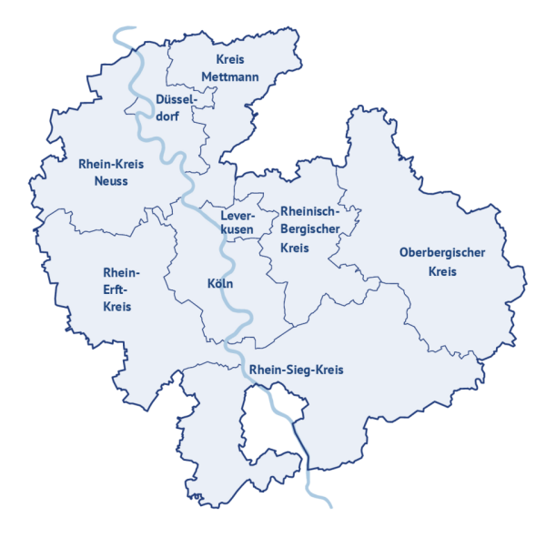
The Oberbergischer Kreis, as a member of Radregion Rheinland e.V., is a key player in the development and networking of cycling infrastructure and tourism in the region.
Radregion Rheinland e.V. assumes a coordinating role in the areas of quality management and the designation of new cycling routes. The association also promotes existing routes on a regional scale.
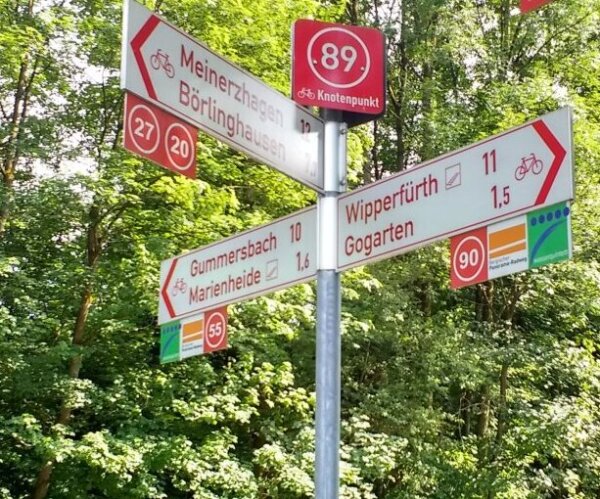
Well-known in the region, the Rhine Region Cycling Area is especially recognized for the node point system with its node point boards. This system was developed in 2015 and uniformly implemented across the region. It enables cyclists to navigate without their own map or smartphone. The node point network is continuously being developed and adapted to new cycle paths and routes.
The Oberbergische Kreis has many high-quality cycling paths. To ensure these routes are frequently used for everyday activities, leisure, or tourism, the paths should be well-maintained and issues promptly addressed. Therefore, the Oberbergische Kreis and the Rheinisch-Bergische Kreis have established a quality management system, which has been transferred to the Bergisches Land Nature Park.
The main goal is to address issues in signage, such as missing or misaligned signs. Reports of issues are forwarded to the relevant authorities. Optimizing the network and individual routes also falls under their responsibilities.
Under the brand "Das Bergische," Das Bergische GmbH, as an umbrella organization, promotes tourism in the rural part of the Bergisches Land, namely in the Oberbergischer Kreis, Rheinisch-Bergischer Kreis, and parts of the Rhein-Sieg-Kreis.
On Das Bergische, you will find many route suggestions for your next bike tour in the Oberbergischer Kreis.
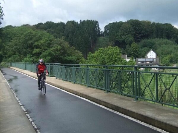
If you prefer to plan your next bike tour yourself, the NRW Bicycle Route Planner is recommended.
There are hardly any limits to planning here. You can also take your desired route with you on the tour: either as a printed map or by installing the app "Radroutenplaner NRW mobil." In the app, you can even get navigation assistance.
Cycling and Climate Protection
Bicycle Counting Stations
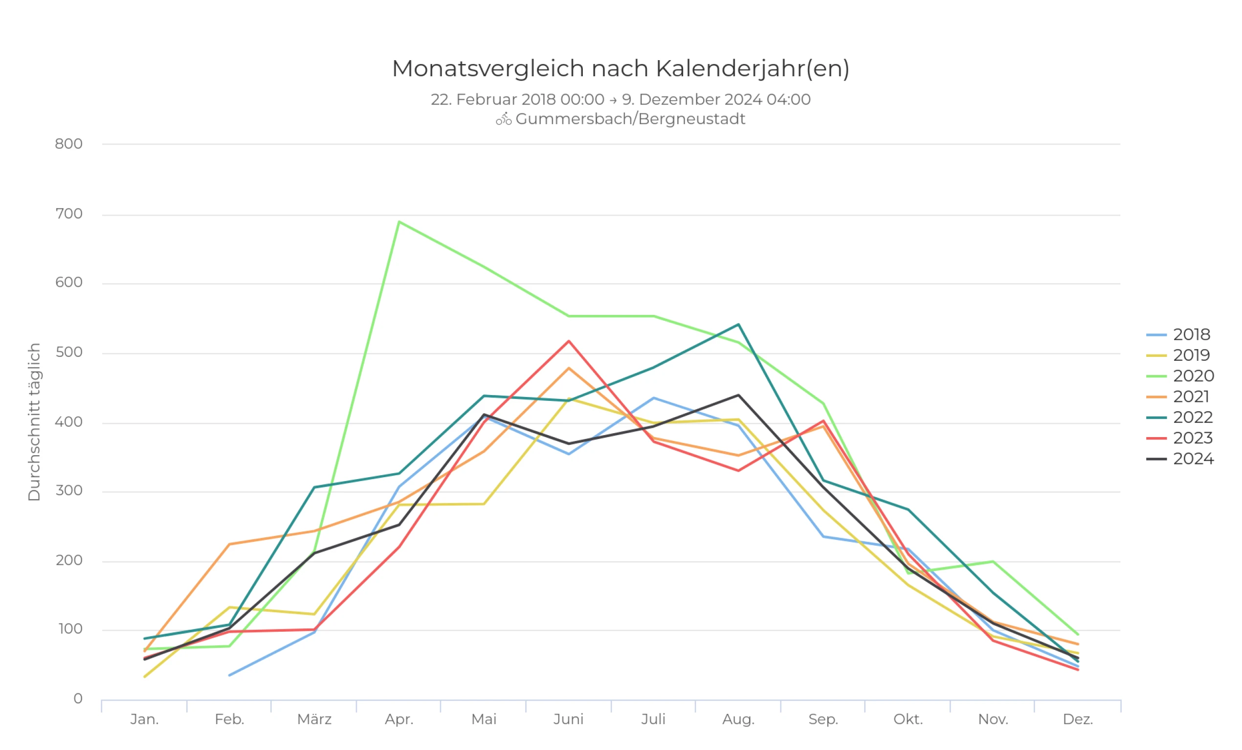
How many cyclists are actually on our bike paths? Since 2018, the number of cyclists has been recorded at three counting stations in the Oberbergischer Kreis, 24 hours a day.
The data is intended to provide information about the current status and development of cycling traffic. The development of the counting station in Gummersbach/Bergneustadt at the Agger-Dörspe stage of the Bergisches Panorama-Radweg is depicted as an example in the graphic.
Cycling route planning
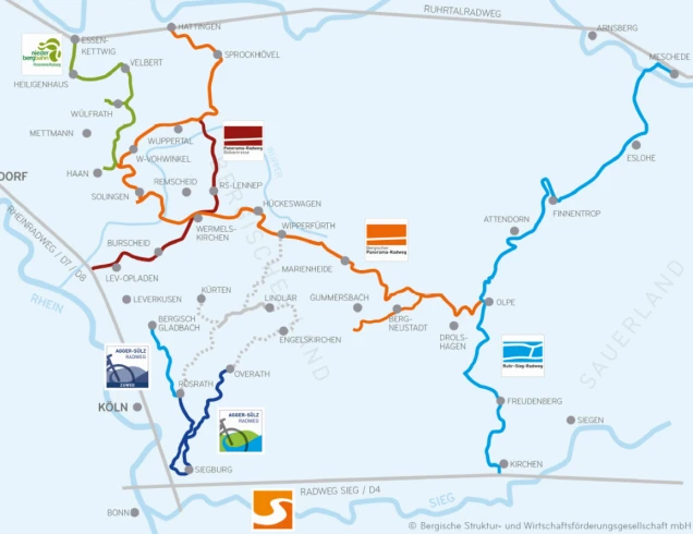
The Oberbergischer Kreis coordinates and participates in the planning of regional cycling route projects, such as the Agger-Sülz-Radweg.
In inter-municipal cooperation,
- the Oberbergischer Kreis (with the municipalities of Engelskirchen, Lindlar, and Wipperfürth)
- the Rhein-Sieg-Kreis (with the municipalities of Lohmar, Sankt Augustin, Siegburg, and Troisdorf)
- the Rheinisch-Bergischer Kreis (with the municipalities of Bergisch-Gladbach, Overath, and Rösrath)
as well as the Region Köln/Bonn e.V. are developing the conceptual planning for the realization of an Agger-Sülz-Radweg. Leadership lies with the Rheinisch-Bergischer Kreis.
Along the natural landscapes that characterize the region, such as Agger and Sülz, this circular cycling route aims to close the gap to the Bergischer Panoramaradweg in Wipperfürth and the Radweg Sieg in Siegburg. Since approximately 87 km of the total 118 km route already consists of cycling paths and routes on low-traffic roads, about 31 km of route improvement is needed.
In 2017, the southern section of the Agger-Sülz-Radweg was opened. This section runs from Rösrath through Siegburg to Overath and is 42 kilometers long.
The planning and development of the gap closures along the rest of the Agger-Sülz-Radweg are being actively pursued by the cooperation partners.
The project has been awarded A-status as part of the REGIONALE 2025 Bergisches RheinLand.
Contact
Lydia Winter
Karlstr. 14-16
2.Obergeschoss, Raum: 214
51643 Gummersbach
