 copyright: Tryfonov - stock.adobe.com
Products of the Office for Geoinformation and Real Property Cadastre
This page was translated from German using artificial intelligence. The translation may contain errors or inaccuracies. In case of doubt, the German original version prevails.
Standard products from ALKIS
The Official Real Property Cadastre Information System (ALKIS) describes and represents all properties (parcels and buildings). The representation and description includes their location, use, size, characteristic topographic features, the results of soil assessment, as well as proof of owners and holders of heritable building rights in accordance with the land register.
Anyone can view the real property cadastre and obtain standard outputs from it.
Standard outputs from ALKIS include, for example:
-
Official Base Map (ABK)
-
Cadastral map/real property map
-
Soil assessment map
-
Certificate of holdings
-
List of owners and co-owners
-
Parcel and owner certificate
The legitimate interest must be demonstrated in a suitable manner if these standard outputs contain information relating to personal data.
The documents to be submitted, e.g. power of attorney, identity card, depend on the individual case.
You can find the current fees in the excerpt from the fee schedule.
The costs are based on the fee schedule for official surveying and official property valuation in North Rhine-Westphalia (VermWertKostO NRW) in its respectively applicable version.
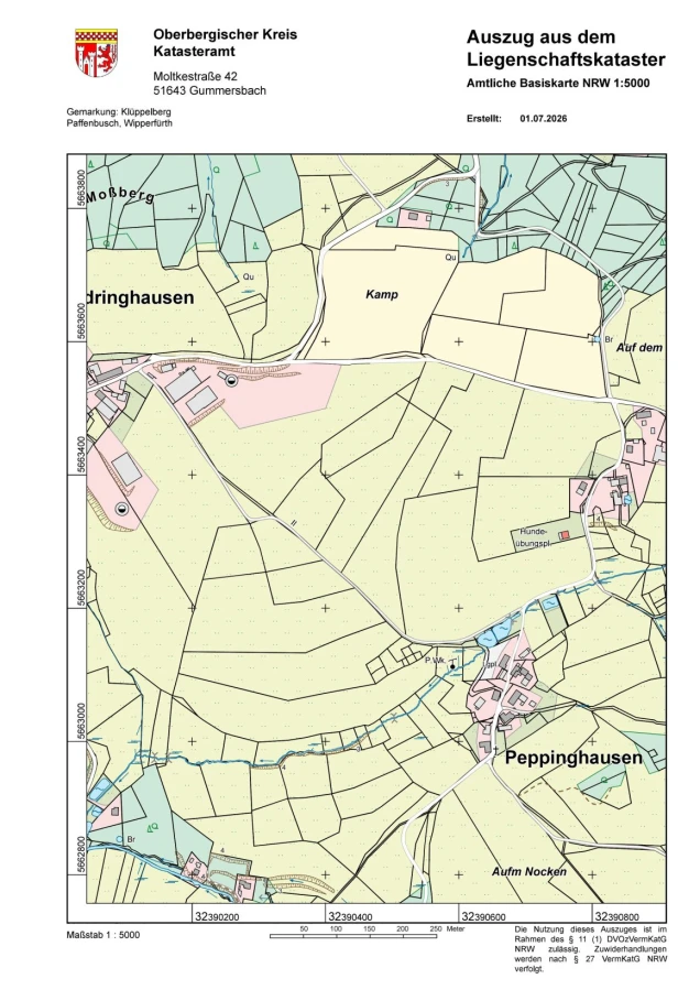
Official Base Map
The Official Base Map (ABK) is a topographic map showing buildings, roads, paths, water bodies and other landscape features.
As a topographic map, the Official Base Map is derived from ALKIS data and supplemented by graphical capture from aerial photographs as well as on-site verification.
The Official Base Map is often used as an overview map for site plans for building applications or as a background map for urban land-use planning. Further topographic maps are derived from the ABK.
You can conveniently order the Official Base Map online at www.obk.de/fluks .
In the Building and Housing geoportal, a simplified representation of the Official Base Map can be displayed and printed.
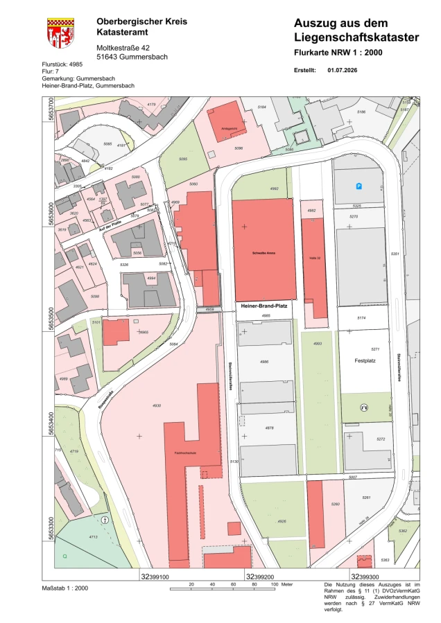
Cadastral map/Property map
A cadastral map ("Flurkarte") is the official land registry map that shows, among other things, land parcels, property boundaries and buildings within an area in a clear, true-to-scale format.
In North Rhine-Westphalia it is required in particular for building applications, property purchases, surveys and planning procedures.
You can conveniently order the cadastral map online via www.obk.de/fluks .
In the Geoportal Building and Housing a simplified view of the property map can be displayed and printed.
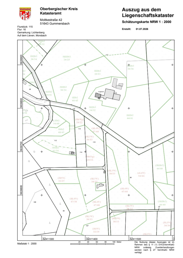
Soil Survey Map
The soil survey map shows the parcels of land, including buildings, as well as the soil survey results for agricultural areas (arable and grassland).
It is needed wherever the agricultural productivity and quality of the soil plays a legal or financial role. It is used by tax offices for tax valuation purposes, and by farmers and planners as an important aid to decision-making when buying, leasing or implementing environmental protection measures.
You can conveniently order the soil survey map online via www.obk.de/fluks .
In the Building and Housing geoportal, a simplified display of the soil survey map can be viewed and printed.
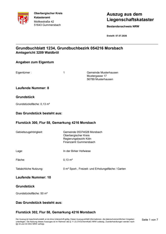
Register Extract (Bestandsnachweis)
The register extract lists all parcels registered on a land register sheet. Unlike a land register extract, it only lists the current cadastral information, such as parcel details, types of use and the yield assessment figures for arable and grassland valuation.
It is one of the ALKIS standard products that can be obtained via the information service of the Office for Geoinformation and Land Registry.
It is often needed for:
-
an overview of the entire landholding
-
notarial transactions
-
property tax
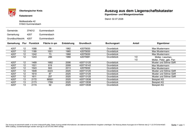
List of owners and co-owners
The owner list contains a listing of the owners and land register sheet numbers, as well as the official area sizes of specific parcels.
It is one of the ALKIS standard products that can be obtained via the information service of the Office for Geoinformation and Land Registry.
If no official standard product is required, ownership information can also be issued as an unformatted .csv text file or as an Excel spreadsheet.
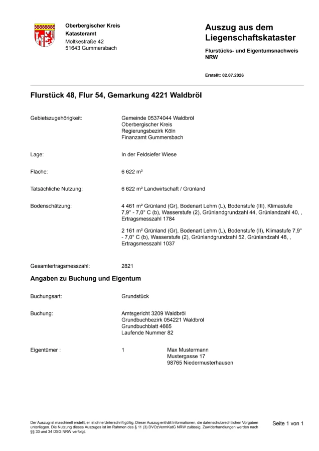
Parcel and Ownership Certificate
The parcel and ownership certificate contains information on:
-
parcel number, location and size
-
owner
-
actual use
It is often needed for:
-
notarial transactions, such as property sales
-
applications to authorities
-
proof of ownership to third parties
It is one of the ALKIS standard products that can be obtained via the information service of the Office for Geoinformation and Land Registry.
Further products
-
German Base Map, historical
-
Leisure maps
-
Historical maps
-
Aerial photographs (current and historical)
-
Stadtplanwerk 2.0 (city map series)
-
Topographic maps
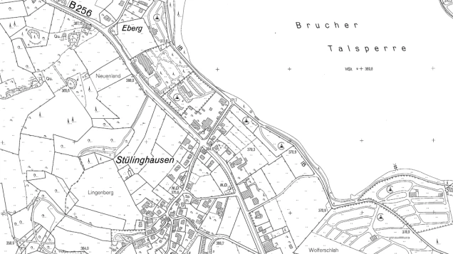
German Base Map (historical)
With the introduction of the ABK (Official Base Map), the DGK (German Base Map) was no longer updated and was decommissioned.
The German Base Map was a topographic map derived from the cadastral map, aerial photographs and on-site verification.
The German Base Map was often required as an overview map in connection with building matters (e.g. for building applications).
It continues to be available as a historical map series, with or without contour lines.
You can find the historical German Base Maps on this external website:
1937 – 2016: German Base Map 1:5,000 | Cologne District Government
or on request from the Office for Geoinformation and Real Property Cadastre of the Oberbergischer Kreis.
It is issued in analogue form (as a printout) or digitally as an image file.
The following details are required for ordering:
-
When ordering, please state: the central parcel with district and section, or the address, or sheet name/sheet number, or coordinate range
-
For digital output, additionally: file format
In the Building and Housing geoportal, the historical German Base Map can be displayed and printed.
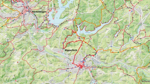
Leisure Maps
By combining data from the official land registry (cadastre) with remote sensing data (laser scanning, aerial photographs, etc.), numerous special topographic maps are created for the Bergisches Land region.
On the external website "Das Bergische" you can find these maps digitally for apps and GPS devices, or in analogue form as high-quality printed cycling and hiking maps.
In the Geoportal Leisure and Tourism a lot of leisure-related information can be displayed and printed.
Historical Maps
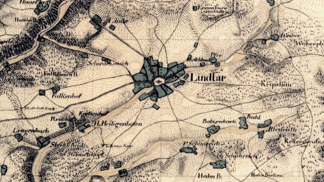
Historical maps before 1912
The historical topographic maps by Le Coq, Tranchot and von Müffling serve regional and settlement-geographical research and are also of interest to those with an interest in history and local heritage.
You can find the historical topographic maps on the external website:
Historical Topographic Maps | Cologne District Government
or on request from the Office for Geoinformation and Land Registry of the Oberbergischer Kreis.
In the geoportal RIO Historical Maps and Aerial Photographs many historical maps can be viewed and printed.
Aerial photographs
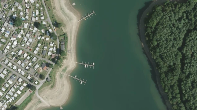
The Oberbergischer Kreis is flown over periodically every 2 years on behalf of the state of NRW. Summer flights (with foliage) and spring flights (without foliage) alternate.
Information on the state-wide aerial survey can be found on these external websites:
Current Aerial and Satellite Image Information | Cologne District Government
Aerial photographs and orthophotos from the state-wide surveys are available here:
Digital Aerial Photographs | Cologne District Government
Digital Orthophotos | Cologne District Government
Further aerial surveys are commissioned by the Oberbergischer Kreis. Information on these surveys and on how up to date the aerial photographs of the Oberbergischer Kreis and the state of NRW are in your area is available on request.
Historical aerial photographs from around 1969 onwards can also be obtained.
Historical aerial photographs and orthophotos from the state-wide surveys are available on this external website:
Historical Aerial and Satellite Image Information | Cologne District Government
For the Oberbergischer Kreis, comprehensive aerial photographs are available in analogue (print) and digital form.
In the RIO Historical Maps and Aerial Photographs geoportal, many historical maps and aerial photographs can be displayed and printed.
City Map Series 2.0
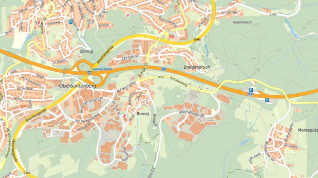
The City Map Series 2.0 is a cross-regional map series created through inter-municipal cooperation. Data from various sources is qualified and integrated into a uniform database. The City Map Series 2.0 is available in various formats. It can therefore be used as a basis for, for example, hiking maps, overview maps or background maps for web applications. Further information and instructions can be found on this external website: Wir auf Karte.
You can download the City Map Series 2.0 from the Geoportal Ruhr.
In the OBK Cloud , municipality-based city map plans and the corresponding street directories are available for download as Open Data (updated: every six months).
We are happy to inform you about further ways to use the City Map Series 2.0.
In the Leisure and Tourism geoportal, the City Map Series can be displayed and printed.
Topographic maps
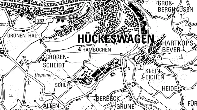
Topographic maps are maps that describe locations.
Depending on the scale, they show the natural structure and appearance of the earth's surface — such as settlements, transport routes, water bodies, terrain shape and vegetation — accurately and completely.
For the state of North Rhine-Westphalia, topographic maps are produced by the district government under statutory mandate at various scales and published as main map series, special maps and historical maps.
The district government offers the maps according to your wishes (plot-on-demand).
Current Topographic Maps | Cologne District Government
We are also happy to produce your custom map from the district government's data - whether as an analogue plot or compiled on a data carrier.
In the RIO Topographic Maps geoportal, many historical maps can be displayed and printed.
Contact
Information - Mr Bickenbach
Fritz-Kotz-Straße 17 a
51674 Wiehl
Data - Mr Knabe
Fritz-Kotz-Straße 17 a
51674 Wiehl